
Seven Falls
Posted by Mark Wilkinson on Jan 1, 2011 in Day Hikes, Front Country | 3 comments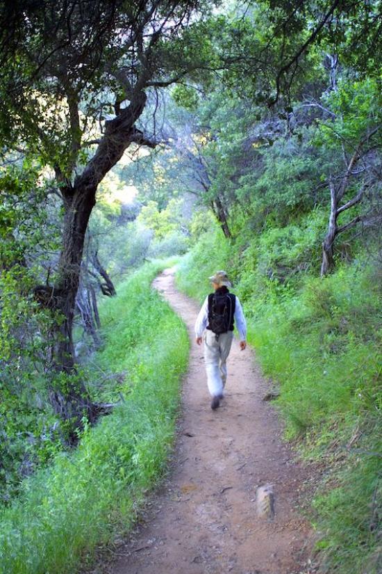

TRAIL INFORMATION
Distance—1.5 miles to Seven Falls; 1.5 miles to Mission Falls
Elevation Gain—400’ to Seven Falls; 1750’ to the intersection Tunnel Trail at Mission Falls
Difficulty—Easy to Seven Falls; hard core to Mission Falls
Topo—Santa Barbara
HIGHLIGHTS
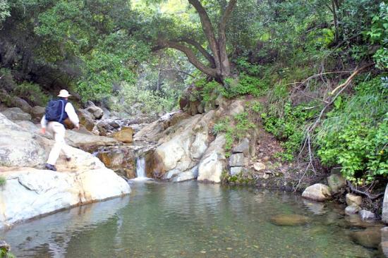
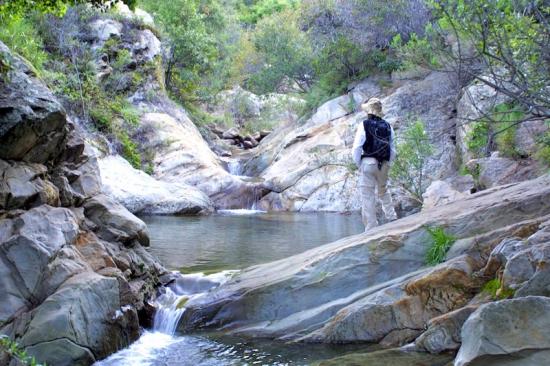
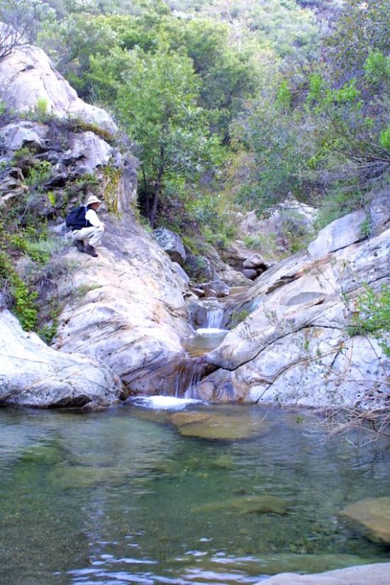
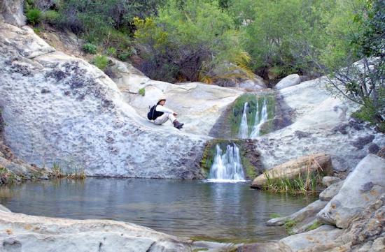
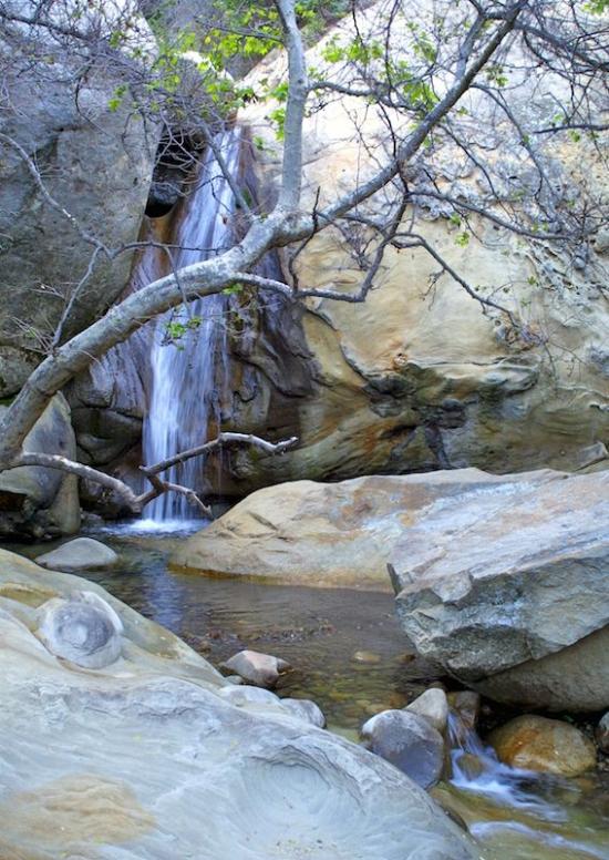
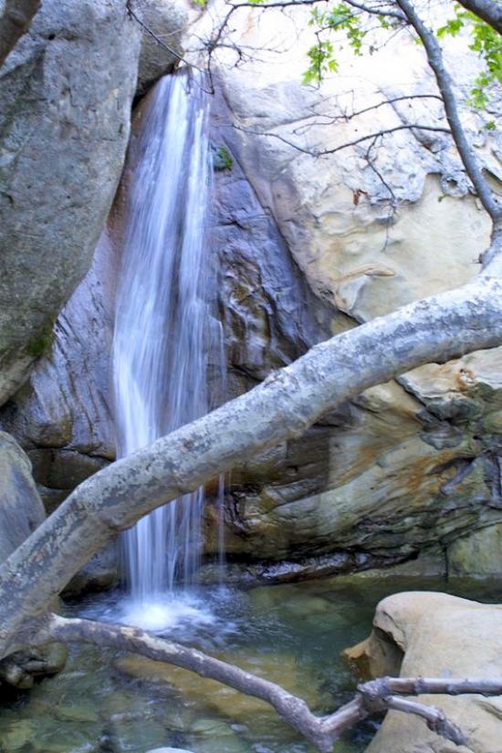
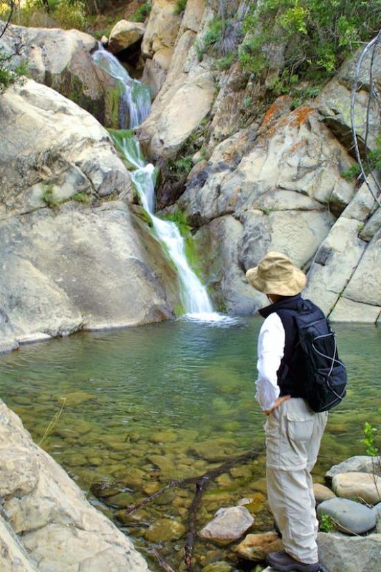
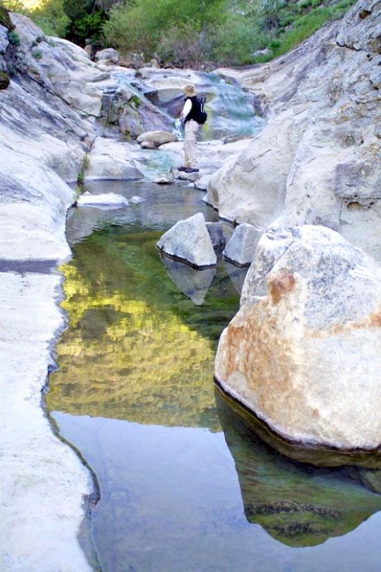
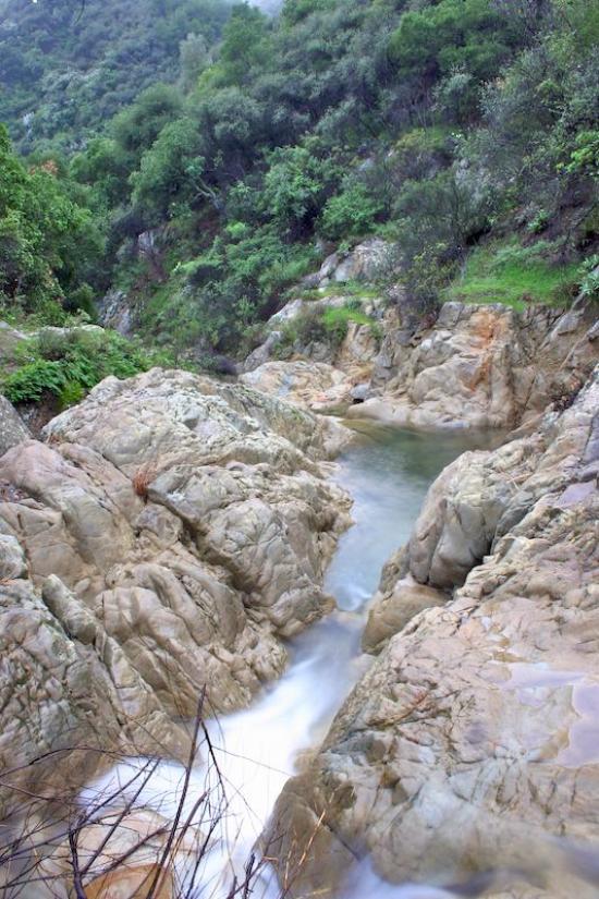
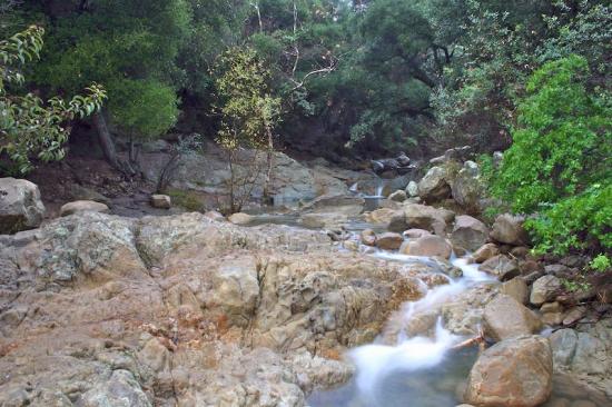
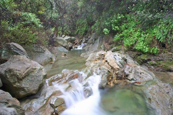
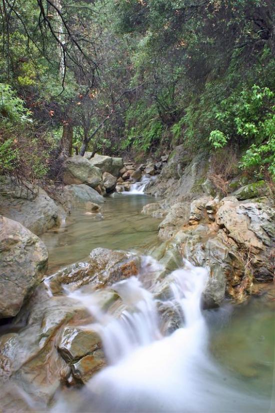
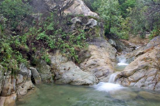
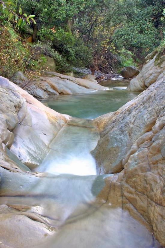
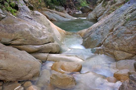
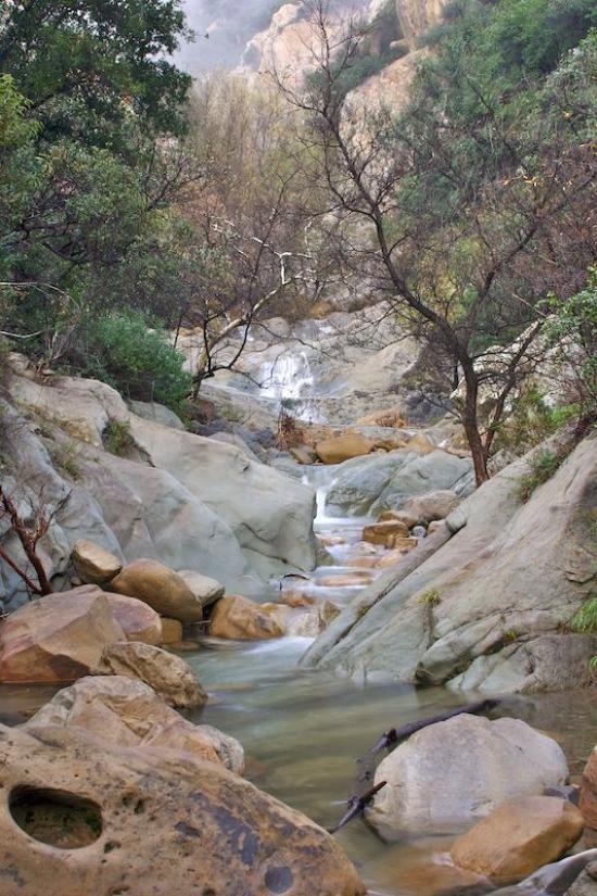
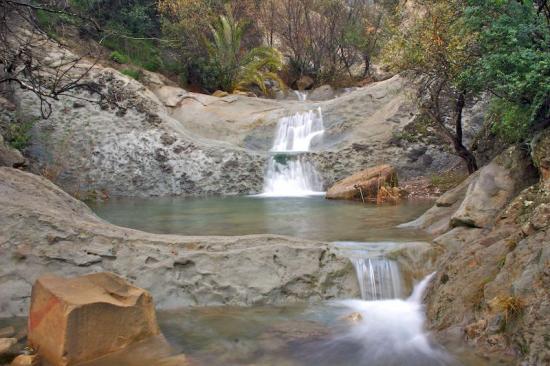
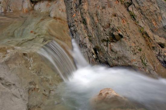
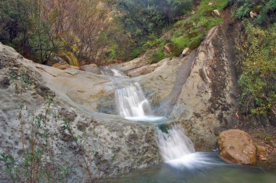
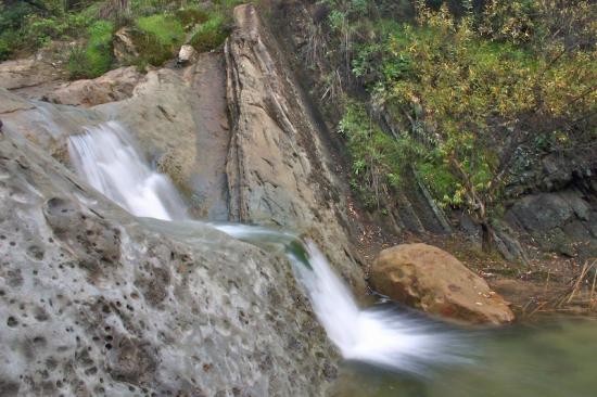
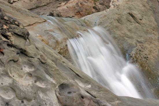
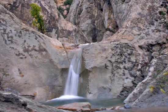
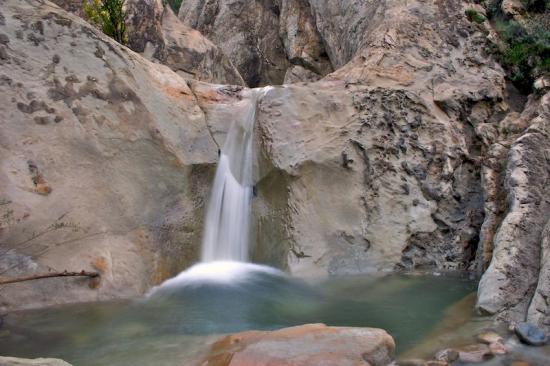
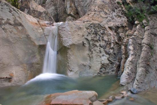
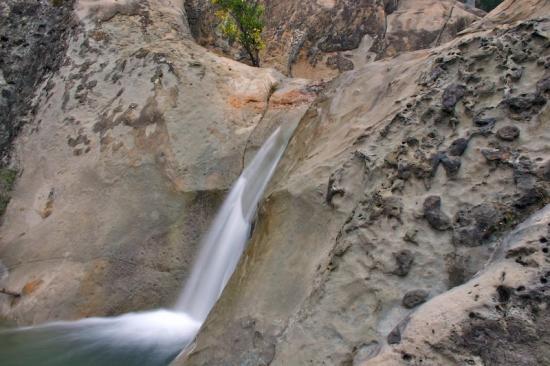
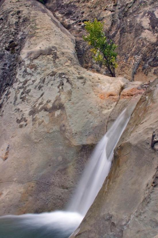
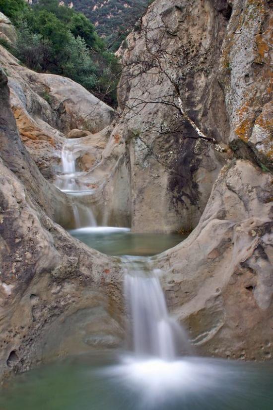
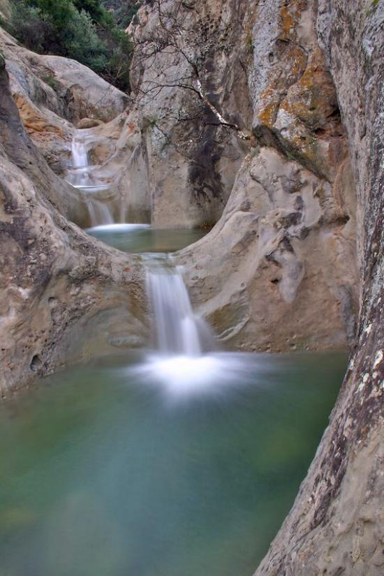
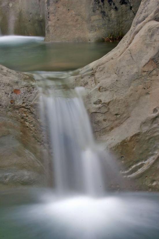
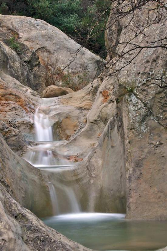
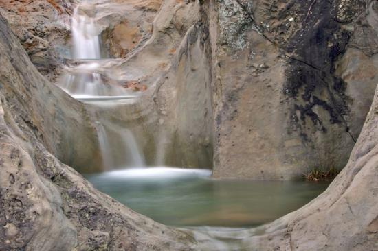
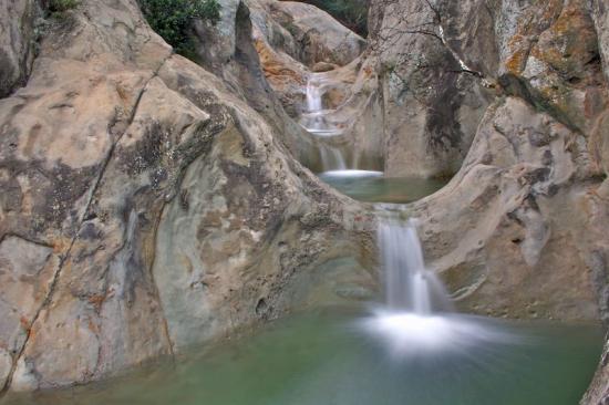
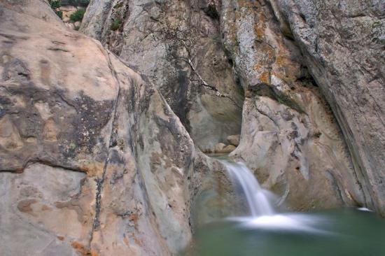
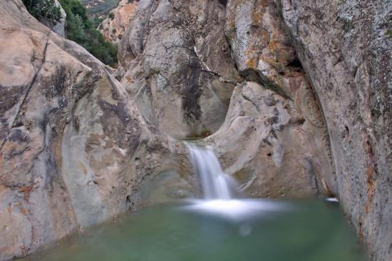
Both the east and west forks of Mission Creek have eroded through the highly resistant Coldwater Sandstone forming in the upper off-trail sections a series of narrows with deep pools, steep falls, and rich green fern coverings—the fabled Seven Falls. For hundreds of thousands of years erosive forces have eaten away at the Matilija Sandstone which forms the bulk of La Cumbre Peak, and the grinding power of the sand and water as they tumbled downhill has etched magical shapes in the rock formations below. One of these is a series of small falls and deep potholes known for more than a century as Seven Falls.
DIRECTIONS
From the Santa Barbara Mission drive up Mission Canyon Road to Foothill and turn right, then turn left several hundred yards later (by the fire station). Continue up Mission Canyon to the Tunnel Road turnoff, a half mile before the Botanic Garden. Continue several miles to the end. Park properly. The police frequently ticket illegally parked cars. The trail begins about three-quarters mile beyond the locked gate.
SETTING THE SCENE
Seven Falls was as much admired in the 1800s as it is now. In Geography of Santa Barbara, written in 1899 by Francis W. Conrad, wrote:
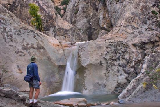
"The music of falling water comes at intervals upon the ear. The uneven trail winding around huge rocks, upon the edge of precipitous banks or plying through the slippery stones at the bottom of the creek, gives just enough elements of beauty, danger, grandeur and loneliness to make a ride here thoroughly enjoyable. Near the head of the canyon is what is known as 'Seven Falls.' The water here falls into seven stone basins in succession. The rocky banks are broadcast with delicate maiden hair ferns and are green with moss. This is a favorite resort. At the head of the canyon is a large rock [Mission Falls] over which the water leaps with considerable force in the rainy season. This fall can be seen from the city."
THE HIKE
To reach this beautiful glen continue past the turnoff to Tunnel Trail and follow Jesusita Trail for two hundred yards until it drops down into the west fork of Mission Canyon. The falls are a quarter mile up this fork.
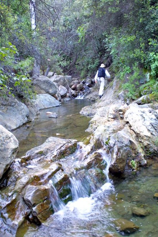
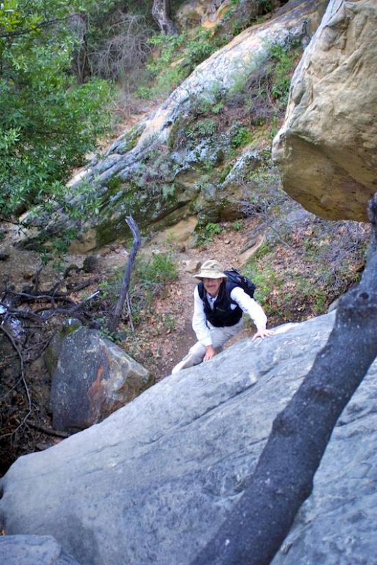
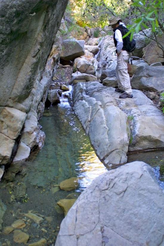
The easiest route to the falls is via the creek. Rock hopping, a bit of scrambling and a few creek crossings lead to the falls. Just as you start upstream there is also a trail of sorts on the left. This will take you through the chaparral part way up to Seven Falls but at some point you will need to follow the creek.
In the spring ,and usually the summer months too, the water will be flowing at the falls, allowing you to swim in the deeper pools or—if conditions are right—slide off the edge of the last falls. The pool below is usually plenty deep but those of us who are cautious check the pool first for any hidden obstacles.
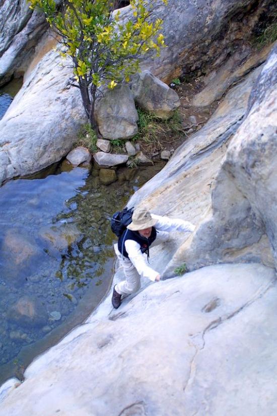
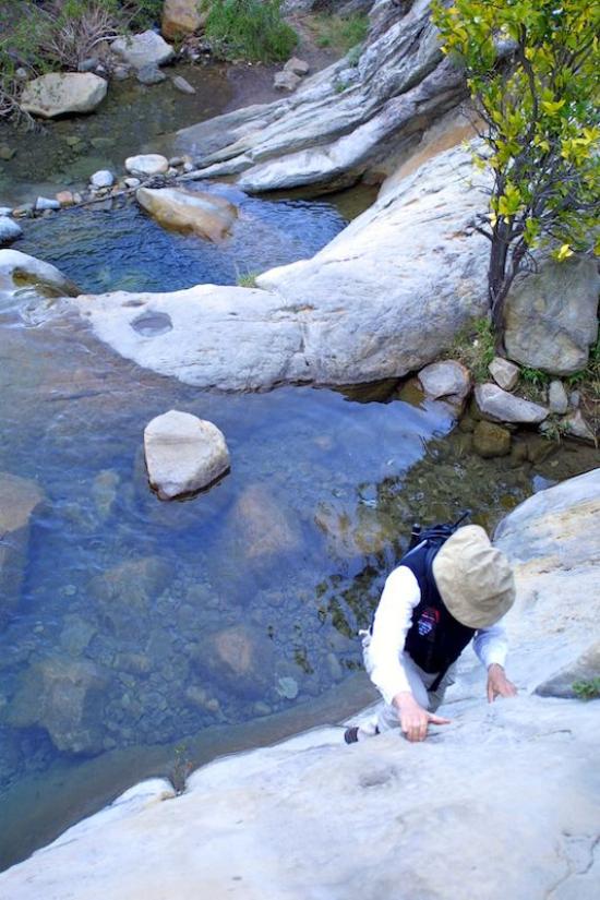
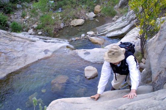
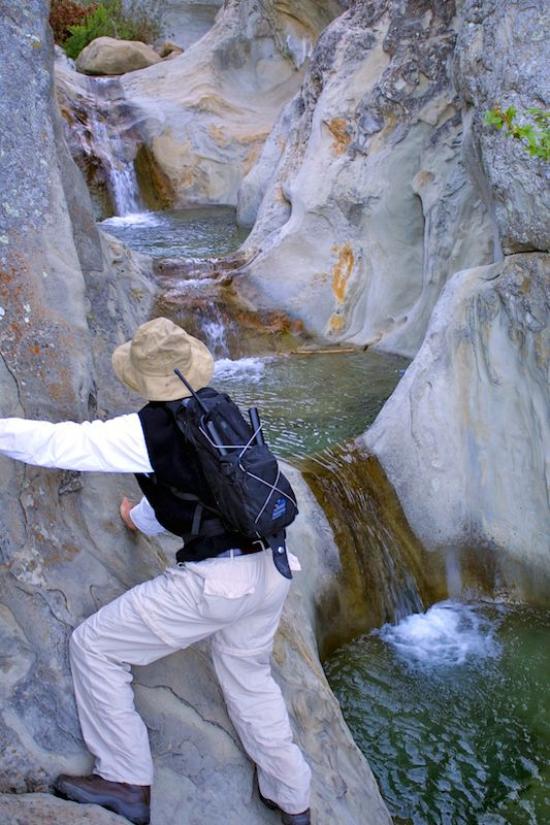
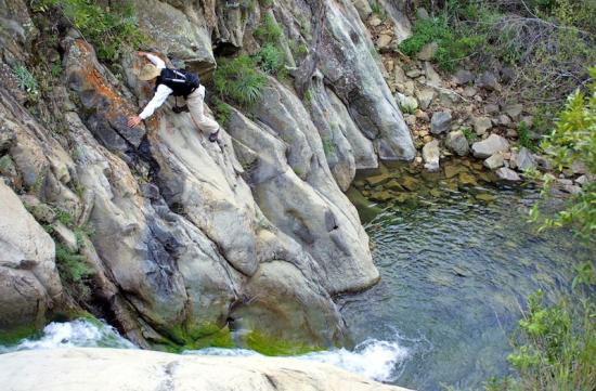
If you are adventurous you might consider hiking up into the upper canyon. The biggest challenge will be getting past the falls. Make your way around what is now a large orange tree (how many of you remember when it was a small seedling?) and look for the toeholds chipped into the rock to help you up the first ten foot wall. From the small apron on top it may seem impossible to get any farther but a few short maneuvers will get you past the last two pools and allow you to hike on. A caution: don't try to make it past by climbing up the rock. It is easy to get stuck and extremely dangerous.
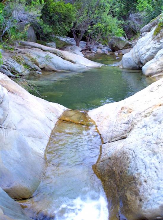
There are several waterfalls in the next few hundred yards, and at some point you will always run into flowing water no matter how dry or late into the season it is. Prior to the early 1900s Seven Falls always flowed year round, but not so after the tunnel was cut through the Santa Ynez Mountains, diverting much of the water which would have otherwise percolated downward.
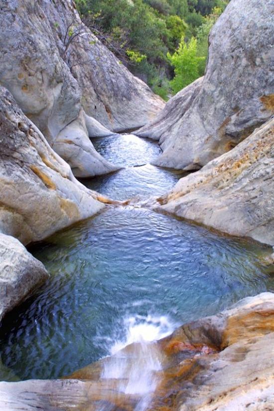
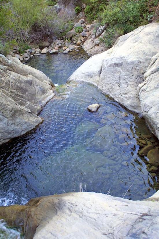
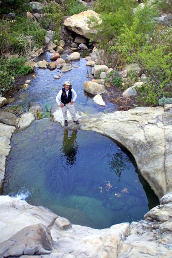
A quarter mile will bring you to another set of pools. These are formed by a last upthrust layer of Coldwater Sandstone, and they are well worth the hike up to them.
It is also possible to scramble up the creek and eventually reach Tunnel Trail at Mission Falls, creating a strenuous but exciting loop. Look for a fork in the creek leading off to the right next to the large stand of prickly pear. The route is straight up the creekbed, steeply up and over lots boulders which chock the creek all the way to Mission Falls. A brush-choked path leads up the right side of the 200’ waterfall.
 1% for the Planet is about coming together, and they believe that forging connections between businesses and nonprofits is a critical aspect of solving the global environmental challenges we face. The nonprofit sector fills a unique and critical role, and the 1% for the Planet model and mission are focused on unleashing the incredible power that is possible when businesses support and engage with these impactful nonprofits.
Hello, will there be waterfalls the last week of dec,?
Thank you
Hello! I’m just wondering if there would be any bathrooms at the start of the trail?
Kids will be going on this hike.. and I don’t want to have to worry about that..
Correction: Two teens