
Historic Slippery Rock Trail • Photo by John Wiley
[UPDATE: The Eastern Goleta Valley Community Plan was approved by the Board of Supervisors in a 3-2 vote. In the process leading up to the vote the County planning staff decided that they could add: and/or through the use of incentives as developed through the revised Goleta Trails Implementation Study. This was not the immediate action we asked for. So the concession was that at some time in the next few years a new trail implementation study would be written and it will include incentives for landowners to grant trail easements to the County.]
The Trails Council is reaching out to community members to get their support for trails proposed in the Eastern Goleta Valley Community Plan decades ago. The plan is now being revised and will guide development for the next quarter century. The County Planning Commission will hold a hearing on the updated version of the Eastern Goleta Valley Community Plan on June 17, 2015.
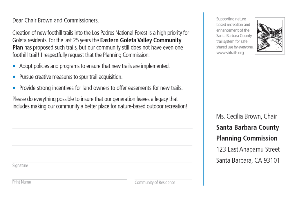
We are providing postcards to community organizations and collecting signed cards at Farmers Markets on Saturday, May 30th and Tuesday, June 2nd. Below is an example of the postcard with the message being sent to the County Planning Commission Chair (click on image to enlarge).
If you would like to participate in the campaign you are welcome to send your own postcard or letter to the address shown above. Alternatively you can send an email to the Commissioners. We have provided an example email at the bottom of this page. Comments need to arrive before noon on June 15th.
More Information
Following are trail related excerpts from the Goleta Valley Community Plan Update for the Eastern Goleta Valley EIR. A PDF of the whole PRT section (with maps) is available here.
(Page 4.13-1)
4.13 Parks, Recreation, and Trails
This section of the Environmental Impact Report (EIR) addresses the potential increase indemand for parks, trails, and recreational facilities that would result from buildout of the proposed Goleta Valley Community Plan Update for the Eastern Goleta Valley (Plan update), along with the impacts that would result from the construction of new facilities.This section also takes into account proposed Plan update policies, development standards, and programs that are intended to minimize potential adverse environmental effects. To address potentially significant impacts that are not minimized to less than significant by the Plan update components, additional mitigation measures are proposed that minimize, reduce, or avoid these adverse environmental effects. These measures, if adopted, would become additional Plan update development standards
(Page 4.13-4)
4.13.1.2 Trails Setting
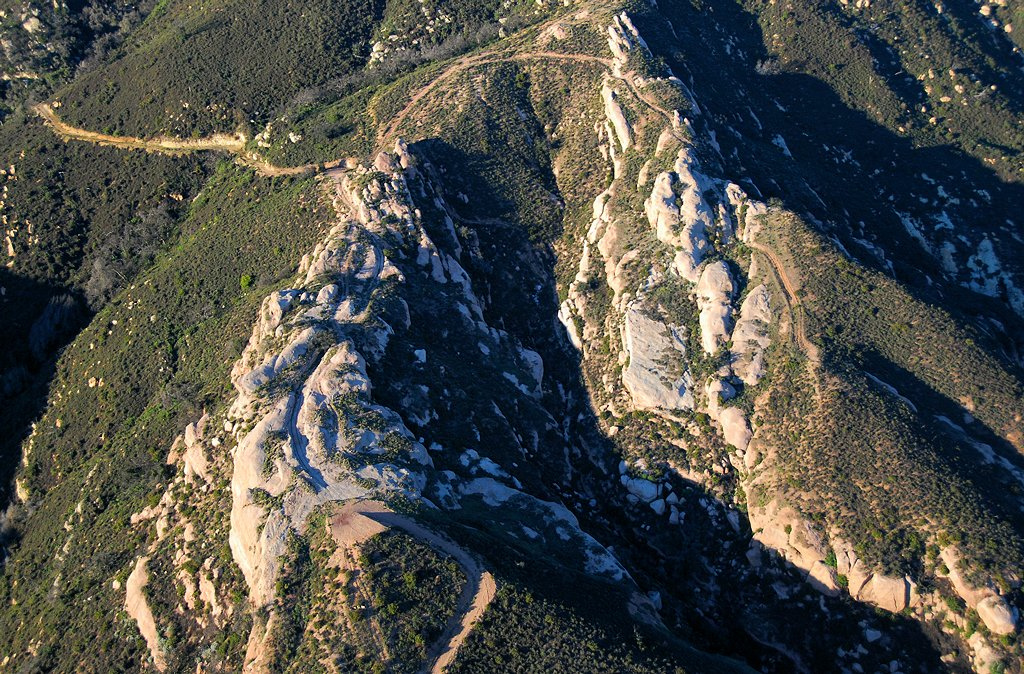
Hiking and mountain biking are very popular activities in the County. Although there are existing trail segments, the Plan area lacks a network of trails with connections to one another and to other popular public trails along the South Coast, such as the Jesusita, Tunnel, or Arroyo Burro Trails. The Plan area also contains historic trails. Although not public, the Fremont and Slippery Rock trails corridors once provided passage from the coast to the Santa Ynez Valley. The Comprehensive Plan Land Use Element provides a Parks, Recreation, and Trails (PRT) Map (PRT-1 and 3) that was last revised in 1988. The Comprehensive Plan delineates a number of proposed trails, which would establish the envisioned comprehensive trail network for the unincorporated area. Additionally, the Goleta Trails Study completed in 1995 provides strategies to implement the trail network
(Page 4.13-10)
Proposed Trails
The Plan update identifies several proposed trail alignments (see Figure 4.13-1) along with Policy PRT-EGV-5.7 which states:
Trail acquisition and siting shall include, but not be limited to, the following:
- San Marcos Preserve to Calle Real County Administration Campus connector trail
- Fremont/Slippery Rock trail
- Windy Gap fuel break/San Antonio Creek trail
- San Marcos Pass trail
- Calle Real County Administration Campus Trailheads and Urban Trails Network, including trails providing public coastal access
- Maria Ygnacio Creek equestrian trail(s)
Although ample recreational facilities and open space in the Plan area are already provided to serve existing and 20-year buildout populations, future development under the proposed Plan update would require the dedication of land or payment of in-lieu fees, or a combination of both, for park and recreational purposes as a condition of approval of a tract map or parcel map. These collected fees or allocated lands would be used to create additional park and recreation facilities, in order to help maintain demand associated with the Plan area’s future residents.
If you have questions or need more information, please contact us.
How Can I Help?
Please take a few minutes to write or send an email to the County Planning Commission such as the example below. Please personalize your message so that the Commissioners will not get too many form letters.
To: Santa Barbara County Planning Commission c/o David Villalobos at: dvillalo@nullco.santa-barbara.ca.us
cc: Janet Wolf, County Supervisor: jwolf@nullcountyofsb.org
Subject: Eastern Goleta Valley Community Plan Trail Update
Dear Chair Brown and Commission Members,
Creation of new foothill trails into the Los Padres National Forest is a high priority for Goleta residents. For the last 25 years the Eastern Goleta Valley Community Plan has proposed such trails, but our community still does not have even one foothill trail! I respectfully request that the Planning Commission:
- Adopt policies and programs to ensure that new trails are implemented.
- Pursue creative measures to spur trail acquisition.
- Provide strong incentives for land owners to offer easements for new trails.
Please do everything possible to ensure that our generation leaves a legacy that includes making our community a better place for nature-based outdoor recreation!
[your name and community of residence]
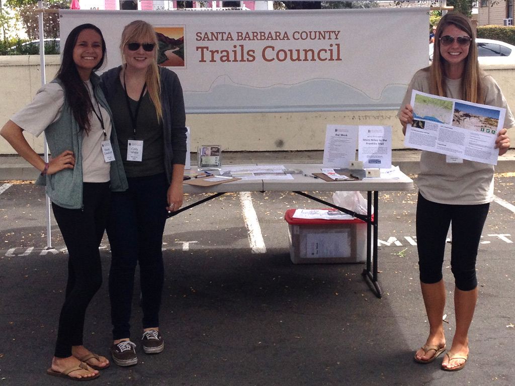
Community Outreach | Promoting Goleta Trails at Farmers Market
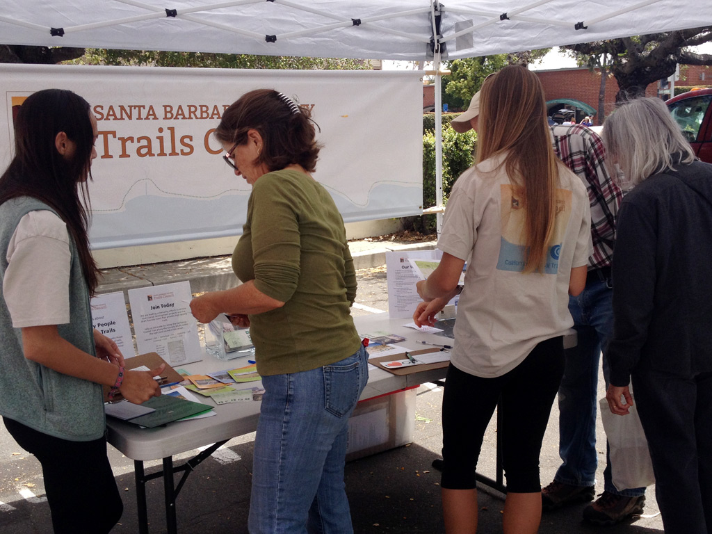
Community Members Learning About Goleta Trails at Farmers Market
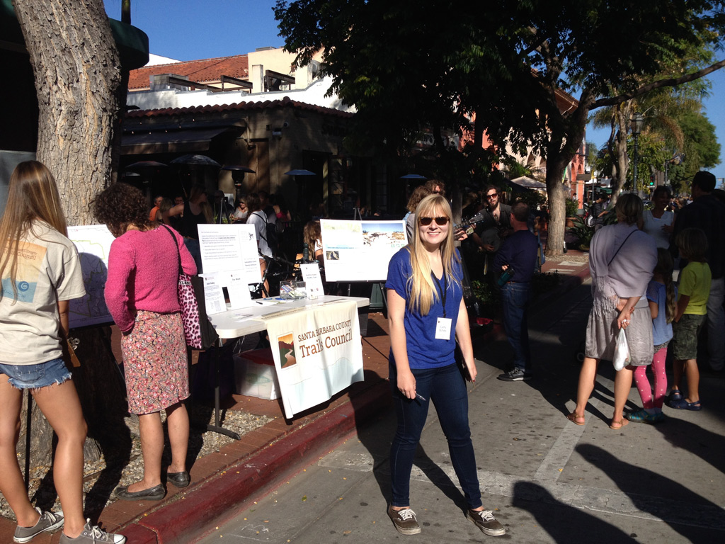
Community Outreach at Tuesday's Farmers Market on State Street
 1% for the Planet is about coming together, and they believe that forging connections between businesses and nonprofits is a critical aspect of solving the global environmental challenges we face. The nonprofit sector fills a unique and critical role, and the 1% for the Planet model and mission are focused on unleashing the incredible power that is possible when businesses support and engage with these impactful nonprofits.